PtMS uses Streets mapping software from Klynas Engineering (http://www.klynas.com/streets.html)to support all the GIS Functions in PtMS. These include:
- Geocoding - location addresses on the map and assign map coordinates
- Route Display - displaying a vehicle schedule route on the map
- Route Sequence Optimization
- Route Drive Directions
- Multiple Point Locations
- GPS Vehicle Tracking
- Route Display - displaying a vehicle schedule route on the map
All of these GIS functions are described in detail in other Scope of Work sections. However, since all GIS functions are depandent on geocoding - assigning map longitude and lattitude coordinates to each pickup and drop-off address, geocoding addresses is described in a sperate section below.
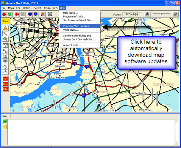
Streets Software and Map Updates
The PtMS workstation licenses include mapping software and map licenses from Klynas Engineering covering all counties in the U.S. The ABS software maintenance and support includes mapping software updates and map updates. Klynas general release complete map updates every 6 months. Mappiing software releases from Klynas are generally every month and these can be downloaded and installed with a single click from the Streets Help Menu.
Using Other Mapping Software Maps
It is possible to use maps from other mapping software system such as ArcInfo, Mapinfo etc with Streets. Almost all of these other mapping systems can save their maps as SHP (Shape) file maps. These SHP files maps can then be loaded into Streets.